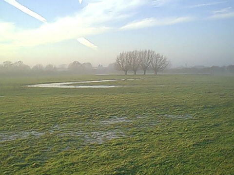
 A vestige of the pre 1760 course of the Frome now in the fields
 The history of the Stroudwater Navigation is a long and complex one. The existing Stroudwater Canal which was opened in 1779 was the result of the third serious attempt to form a navigation between the River Severn and Stroud.
The River Route proposed for the restoration of navigation uses the canalised sections of the River Frome developed as part of the first two navigation schemes built in the 1740s and around 1760.
A vestige of the pre 1760 course of the Frome now in the fields
The first navigation was built by Richard Owen Cambridge of Whitminster House in the 1740s using the powers granted under an Act of Parliament of 1730. Three miles of the River Frome were made navigable from Framilode to the Bristol Road (A38).
John Kemmett continued the canalisation of the river in 1759 using cranes instead of locks to transship cargos from one level to the next at each mill up the valley as far as Stonehouse. This method of avoiding any loss of water to the mill owners was ingenious but not very practical and the navigation operated for only a few years.
In 1775, work started on the Stroudwater Canal which avoided the use of the river for most of its route. It was opened in 1779 and in 1789 became part of the through route between the rivers Thames and Severn. It was a successful canal, well supplied with water and lacking any expensive engineering works, which earned high profits for its shareholders. Railway competition had less of an effect on the Stroudwater Canal than most and it was the growth in road carriage which finally drew the last trade away in the early 1940s.
The Stroudwater Canal was not nationalised in 1948 and remains in the hands of the original Company of Proprietors of the Stroudwater Navigation to this day, although some sections lost at the time of the building of the M5 are no longer in Company ownership. The Company relieved itself of the obligation to maintain navigation in 1954 through an Act of Abandonment but retained most of its other powers.
The Whitminster - Westfield section of the canal has been badly affected by flood prevention works to the River Frome and the building of the M5 and its associated road improvement works. In the latter case, there seemed to be a deliberate policy in force at the time to cause the maximum damage possible to the canal for a considerable distance either side of the actual road works themselves. Similar plans to destroy further lengths of the canal lead to the formation of the Stroudwater Canal Society, the forerunner of the Cotswold Canals Trust.
From early scepticism in the 1970s, the proposals to restore the Stroudwater Navigation and Thames and Severn Canal now have widespread support from the public, all the Local Authorities and MPs along the route, British Waterways and, in principle, from the Environment Agency.
Several million pounds have already been spent on restoration works and efforts are advancing to secure major funding to enable some of the major obstacles to be overcome.
The length between Whitminster Lock and Westfield Bridge cuts off the main part of the Stroudwater Canal from its link with the national waterway network and it is therefore important that agreement is reached to identify how this gap is to be overcome.