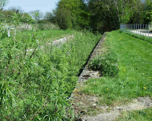
Boxwell Spring Lock - April 2002
Boxwell Springs picture gallery
The Boxwell Springs length, which is located to the east of South Cerney of the T&S Canal has an unusual history. When the canal was built back in the 1780s, there was no lock at Boxwell Springs – this was added 3 years after the canal opened when it was realised that the outflow level of Boxwell Springs was significantly lower than that of the canal. The new lock became necessary because the two Wildmoorway Locks had falls of 11ft compared with the 9ft 6ins approx falls of the locks upstream. This meant that the pounds upstream of the Wildmoorway Locks would empty themselves as boats passed through.
In order to improve the situation, the T&S Company inserted Boxwell Spings Lock to gain access to water from at least some of the higher level springs. In practice, this meant inserting a new lock with a fall of 3ft 6ins, deepening the canal by 3ft 6ins all the way to Wildmoorway Upper Lock about half a mile away and the removal of the top 3ft 6ins of Wildmoreway Upper Lock including substantial modifications to the overflow weir and lower gates. This was not a trivial exercise and must have resulted in a substantial stoppage.
The new lock at Boxwell was built entirely of stone with cut stone above the lower water level and rough stone below it. Because of its small fall, both sets of gates had paddles. The overflow wier is on the offside and takes the form of a length of reduced height lock wall funnelling into a culvert which discharges below the bottom gates.
Boxwell Spring Lock - April 2002
At some point in the 1980s, the towpath wall of the lock started to collapse due to frost damage to the rough stone lower part of the wall. The lock became one of the first Dig Deep projects and all of the masonary parts of the lock were restored. In the case of the towapath wall, this was near to a complete rebuild using very substantial blocks of reconstituted stone. Stop planks have been inserted at the lock and the pound above holds usually holds water during the winter and spring.
Near to the Lock is
Crane Farm. Until the early 1980s, this was occupied by an old
gentleman with a wooden leg known locally as “Old Tom”. He lived alone
at the farm, which still
had no electricity at this time. He rememberd the boats using the canal
and
the repuddling of the section of the canal below the lock early in the
20
th century. He had produced a carving of the lock in limestone
showing
a boat and the date of 1912. Shortly after his death, the only
remaining cast
iron milestone plate in this area was stolen from its stone adjacent to
the
towpath just upstream of the lock.
Below Boxwell Sping
Lock, the canal passes over limestone for a short length. It was from
these limestone beds that the Boxwell Springs issued. The nature of the
canal bed here is very similar to that on parts of the summit with the
risk of high water tables in the winter punching holes in the clay
lining which subsequently release water from the canal into the ground
later in the year. The canal widens out
into a winding hole at the point where the springs once entered the
canal. It is said that over a million gallons a day flowed into the
canal until
the Latton Pumping Station opened – and they then drid up for good.
Nearby,
a culvert under the towpath leads to an overflow weir to take excess
water
out of the canal to the River Churn nearby.