Golden Valley Picture Gallery Back to T&S Canal Index
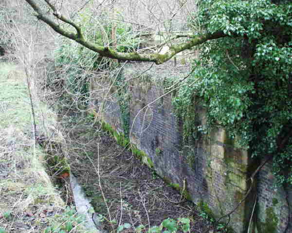 There are 7 locks in quick succession, the first being under the Daneway
Arms car park and the following six in the woods below Daneway Bridge. Photos
survive of this length of canal in the years leading to the abandonment of
this part of the canal but water is usually absent even though the gates
were still in place.
There are 7 locks in quick succession, the first being under the Daneway
Arms car park and the following six in the woods below Daneway Bridge. Photos
survive of this length of canal in the years leading to the abandonment of
this part of the canal but water is usually absent even though the gates
were still in place.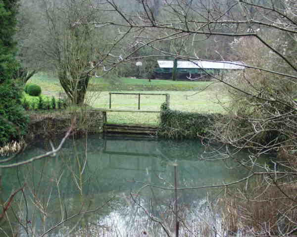 Between Daneway Upper Lock (sometimes called Daneway Bridge or Summit Lock)
and Daneway Lower Lock (sometimes called Daneway Basin Lock) is the concrete
lined Daneway Basin. This was built as a temporary terminus while the tunnel
was being finished. A few years ago, the then owner decided to infill the
basin with builders rubble without planning consent. On discovering he needed
it, he increased the speed at which he was filling in the basin in the expectation
of getting retrospective planning permission - big mistake! Cotswold District
Council, with full backing of the Cotswold Canals Trust made him remove all
but a thin layer to cover the floor of the basin and it therefore remains
visible (in spite of attempts to screen it off) as an important heritage
feature of the canal.
Between Daneway Upper Lock (sometimes called Daneway Bridge or Summit Lock)
and Daneway Lower Lock (sometimes called Daneway Basin Lock) is the concrete
lined Daneway Basin. This was built as a temporary terminus while the tunnel
was being finished. A few years ago, the then owner decided to infill the
basin with builders rubble without planning consent. On discovering he needed
it, he increased the speed at which he was filling in the basin in the expectation
of getting retrospective planning permission - big mistake! Cotswold District
Council, with full backing of the Cotswold Canals Trust made him remove all
but a thin layer to cover the floor of the basin and it therefore remains
visible (in spite of attempts to screen it off) as an important heritage
feature of the canal.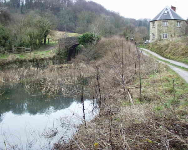 Puck Mill Upper lock has a bridge over its tail and an aqueduct carrying
the Frome underneath the whole structure - it, the lower lock and a significant
length of canal here is owned by the Cotswold Canals Trust following a land
swap of a former lock keeper's cottage.
Puck Mill Upper lock has a bridge over its tail and an aqueduct carrying
the Frome underneath the whole structure - it, the lower lock and a significant
length of canal here is owned by the Cotswold Canals Trust following a land
swap of a former lock keeper's cottage.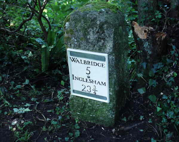 A long pound follows which passes the old Chalford waterworks and a restored
milestone with replica plate. This leads to Golden Valley (or Valley) Lock
which has received considerable restoration work at its top end by the CCT.
The bridge at the tail of this lock may prove to be the one providing the
lowest headroom of any along the canal.
A long pound follows which passes the old Chalford waterworks and a restored
milestone with replica plate. This leads to Golden Valley (or Valley) Lock
which has received considerable restoration work at its top end by the CCT.
The bridge at the tail of this lock may prove to be the one providing the
lowest headroom of any along the canal.| To Picture Gallery
|
|
|
Maintained by: ken.burgin@pikelock.com |
Copyright © Ken Burgin 2002 - all rights reserved |