Thames Head to Coates     Picture Gallery        Back to T&S Canal Index


The eastern part of the summit of the Thames and Severn Canal between Thames Head and the Tunnel was the most prone to leakage. Problems occurred when ground water levels rose during periods of wet weather in the winter punching holes in the clay lining of the canal.

For much of the distance from Siddington to Thames Head, the canal ran on relatively high ground and, with the exception of one or two places such as Bluehouse, the ground water pressure problems were less prevalent. As the canal approached the tunnel it became lower and lower in relation to the surrounding land and from Trewsbury Bridge onwards, the canal is in a cutting of ever increasing depth until it plunges into the tunnel itself.

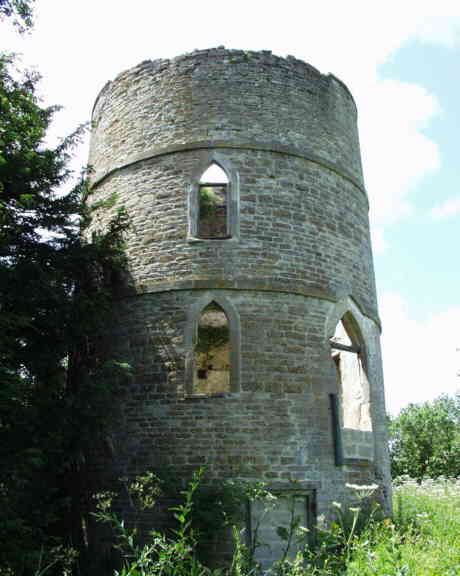
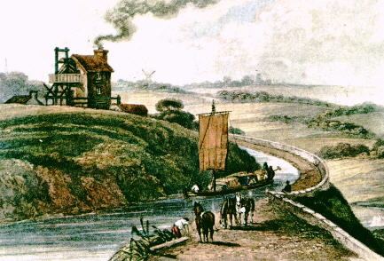
  Thames Head was the location of the one of the three main water supplies to the summit of the canal, the others being the River Church in Cirencester and springs within the tunnel. These two other supplies were unreliable in summer so from the early days of the canal, there was a pump at Thames Head. The first was a windpump but this was soon replaced by a Bolton & Watt steam engine. Over the years, the Thames Head supply was developed with long underground galleries feeding an oval shaped well from which the water was drawn. This supply was very reliable but expensive to operate and it is probably that the water level in the canal was allowed to drop in times of light traffic resulting in damage to the clay lining and additional leakage problems.

Thameshead Bridge Plaque

 Thames Head Bridge still survives but is bypassed by the main road which, since 1962,  crosses on a culverted causeway. There was a small wharf here and the wharfinger's cottage still survives as a domestic dwelling adjacent to the original bridge. A plaque on the outside of the eastern parapet of the original bridge (on the west side of the current road) commemorates the canal.


Between Thames Head and Trewsbury Bridge, there used to be a substantial stone quarry; its output was taken away in boats and beyond this a set of stop plank narrows with a large drainage paddle which discharges very near the source of the Thames closely.

It is interesting to note that Thames Head only was designated as the official source of the Thames during the 19th century when the T&S Canal was operating. This followed various claims and counter claims as to which location was appropriate as the source of the Thames with Seven Springs at the head of the River Churn being the other main contender.  It is also interesting to note that historic maps of the canal are marked with with the word "leaks" near this location. Could it be that the official source of the Thames was in fact caused by a leak in the canal bed? The source of the Thames is almost always dry except after periods of very wet weather and these rare occasions seem to co-incide with water reaching this length of the canal from the springs in Sapperton Tunnel.


 Trewsbury Bridge itself is perhaps the best surviving example of a rough stone Thames & Severn Canal bridge - most of the other survivors have been the subject to extensive brick patching whilst this one remains almost entirely in stone.


The next bridge carries the Swindon - Gloucester Railway over the canal on an impressive skew masonry bridge reportedly designed by Brunel.


Just beyond the railway bridge is the derelict Coates Roundhouse. Like Inglesham and Marston Meysey, this one had an inverted conical roof. Little now remains of the internal timber work. Behind the roundhouse is a small rectangular extension which used to house the kitchen and a separate stone structure housed the privy.

In front of the roundhouse is a set of stop plank groves which would have been used to isolate the sections of the canal on either side for maintenance or to prevent loss of water from one section to the other due to leakage.

The cutting carrying the canal becomes even deeper as the canal carries on its westwards course to Tarlton Bridge. This is an elegant but not original structure, its predecessor having to be replaced in the 1840s.


 The last length of the canal leading to the tunnel is called the King's Reach following a visit from George III during the time of the tunnel's construction. This length suffered badly from leakage until Gloucestershire County Council constructed a sophisticated concrete channel with side vents above the waterline to relieve the ground water pressure -a solution which has proved to be totally effective for about a century now.


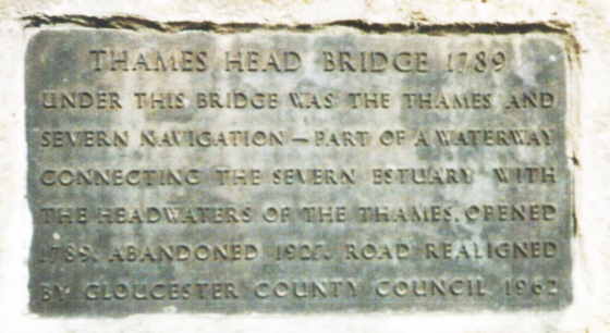
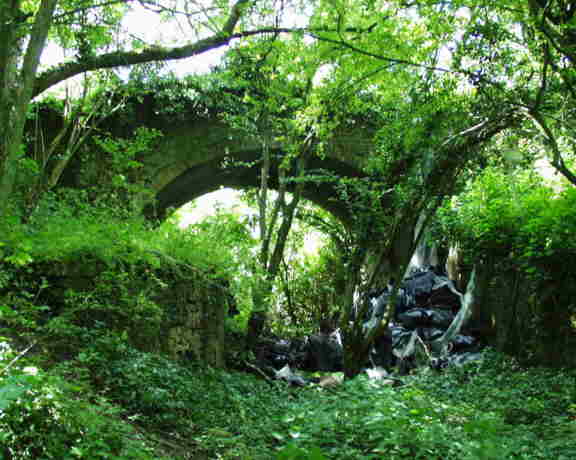
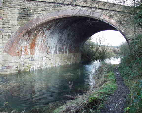
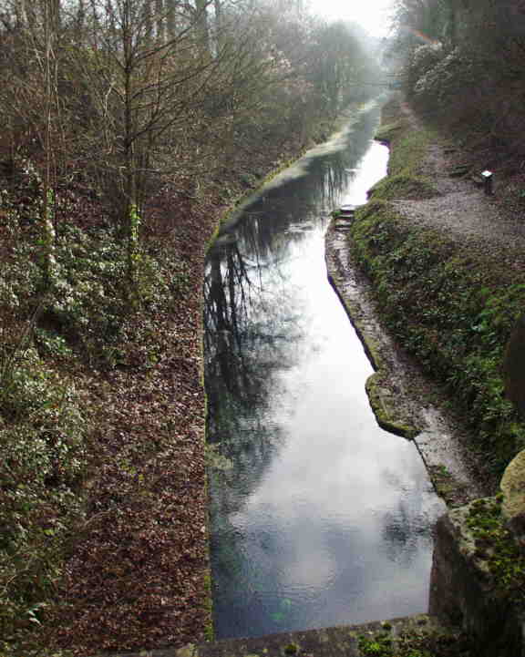
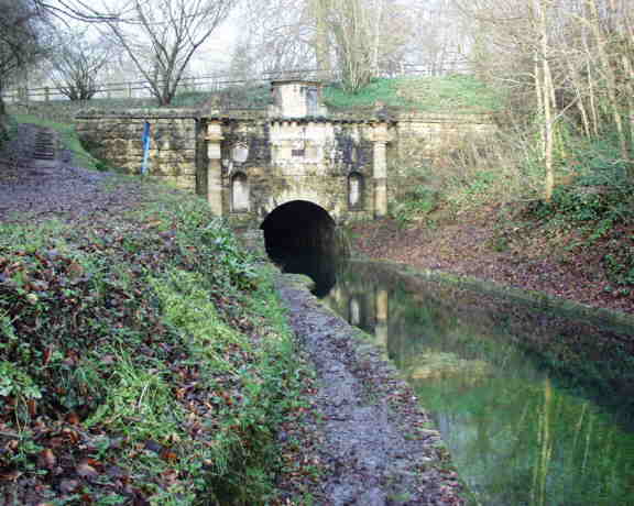
Eventually the difference in level between the surrounding ground and the canal bed became too great and the canal had to be tunnelled. The Coates Portal of Sapperton Tunnel is a magnificent piece of Georgian Classical stonework and is almost certainly the grandest canal tunnel entrance in the country. Lying within the Bathurst Estate, its design and that of the Gothic Portal at the Daneway end are thought to have been heavily influenced by Earl Bathurst who himself was a supporter of the Thames & Severn project.


Above the portal is the Tunnel House Inn. This was originally built as a hostel for the men building the tunnel and later became a pub. For may years it would have been the place where leggers would have waited to offer their services to passing boat crews about to enter the tunnel. Originally, the building had three floors but a sever fire in the 1950s virtually gutted the building and the top floor was never rebuilt.


To Picture Gallery

Back to T&S Canal Index

Maintained by: ken.burgin@pikelock.com

Copyright © Ken Burgin 2002 - all rights reserved