Stroudwater Canal route flood bank interface issue
There is an issue of flood bank integrity if the
River Frome and the remaining length of the the Stroudwater Canal from Latham
to the A38 are to be connected.
The River Frome summer water level and that of the canal are similar but
the river flows between high flood banks and the water level can become significantly
higher than that of the canal at times of heavy rainfall.
If the river route is used to restore through navigation, it is not necessary
to connect the canal and river together.
If the canal route is used or if it was decided that the truncated arm of
the canal should be connected to the river even if through navigation follows
the river, it will be necessary to carry out flood protection works.
There are two immediately apparent ways to providing protection:-
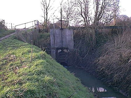
- Construct a lock or a flood gate where canal and river join. This
would be expensive and has management issues in that the lack of a reliable
differential in normal water levels would prevent the use of a conventional
mitre gated lock. Although this system might also cause the canal length
to become a sump, this is not considered to be a particular problem as a
weir already discharges surplus water from the canal into a low level drain
which passes under the River Frome.
- Build up the banks (particularly the south bank) of the canal
to the same or higher level as the north flood bank of the river at Latham
where they join. This is simpler but care would be needed to design the scheme
to avoid the risk of flooding property adjacent to the canal at the A38. A
further issue arises with headroom under any new crossing of the A38 at times
when the canal level rises due to the river - the extent of this would need
to be understood when designing the road crossing.
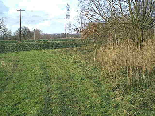
The River Frome as approached by the reedy bed of the Stroudwater Canal.
Note the flood bank separating the canal from the river channel. Simply cutting
through it would result in high levels of water in the river backing up the
canal and over topping the banks in times of high rainfall.
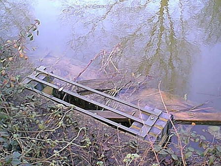
Currently, any excess water in the canal flows over this small weir into
a nearby deep drainage ditch. An operational canal might demand a larger
weir to cope with additional lockage water at times when the river levels
were higher than that of the canal as might be the case if a flood control
structure were to be built here.
The deep drain passes under the River Frome near the site of Latham Aqueduct.
Back to Map 2